Category:Files with coordinates missing SDC location of creation (54° N, 1° W)
Jump to navigation
Jump to search
Media in category "Files with coordinates missing SDC location of creation (54° N, 1° W)"
The following 200 files are in this category, out of 2,164 total.
(previous page) (next page)-
 "HMS Endeavour" replica , Whitby.jpg 3,089 × 2,190; 1.51 MB
-
 'Beached' Boat - geograph.org.uk - 1546946.jpg 640 × 387; 137 KB
-
 'Lion' on the level crossing at Grosmont - geograph.org.uk - 790399.jpg 640 × 480; 202 KB
-

-
.jpg/90px-%27Old%27_Spital_Bridge_(geograph_5578576).jpg) 'Old' Spital Bridge (geograph 5578576).jpg 3,240 × 4,320; 3.65 MB
'Old' Spital Bridge (geograph 5578576).jpg 3,240 × 4,320; 3.65 MB
-
 'The Snicket' - geograph.org.uk - 800967.jpg 640 × 400; 65 KB
-
 'The Snicket' - geograph.org.uk - 800973.jpg 640 × 399; 70 KB
-
 'The Snicket' - geograph.org.uk - 800988.jpg 640 × 400; 92 KB
-
.jpg/120px-...and_we_follow_%2C_just_like_sheep%21_(5910367936).jpg) ...and we follow , just like sheep! (5910367936).jpg 3,618 × 1,386; 4.48 MB
...and we follow , just like sheep! (5910367936).jpg 3,618 × 1,386; 4.48 MB
-
.jpg/120px-12_Church_Lane%2C_Bempton_(geograph_5745262).jpg) 12 Church Lane, Bempton (geograph 5745262).jpg 1,024 × 768; 229 KB
12 Church Lane, Bempton (geograph 5745262).jpg 1,024 × 768; 229 KB
-
 146-152 Castle Road, Scarborough - geograph.org.uk - 5518222.jpg 1,024 × 768; 173 KB
-
 155345 departs for Hull plus a super array of semaphores at Bridlington - 48615586733.jpg 3,417 × 2,822; 1.78 MB
-
 155345 departs for Hull plus a super array of semaphores at Bridlington - 48615934376.jpg 3,935 × 2,367; 2.25 MB
-
 155345 departs for Hull plus a super array of semaphores at Bridlington.jpg 3,774 × 2,136; 1.29 MB
-
-

-

-

-

-
-

-
.jpg/120px-158_Squadron_memorial_(geograph_6907659).jpg) 158 Squadron memorial (geograph 6907659).jpg 1,024 × 683; 543 KB
158 Squadron memorial (geograph 6907659).jpg 1,024 × 683; 543 KB
-
.jpg/120px-158_Squadron_Memorial_at_Lissett_(geograph_6653921).jpg) 158 Squadron Memorial at Lissett (geograph 6653921).jpg 1,024 × 694; 108 KB
158 Squadron Memorial at Lissett (geograph 6653921).jpg 1,024 × 694; 108 KB
-
.jpg/120px-158_Squadron_Memorial_at_Lissett_(geograph_7206938).jpg) 158 Squadron Memorial at Lissett (geograph 7206938).jpg 4,711 × 3,322; 3.38 MB
158 Squadron Memorial at Lissett (geograph 7206938).jpg 4,711 × 3,322; 3.38 MB
-
.jpg/120px-158_Squadron_War_Memorial%2C_Lissett_(geograph_6455218).jpg) 158 Squadron War Memorial, Lissett (geograph 6455218).jpg 4,500 × 3,582; 4.81 MB
158 Squadron War Memorial, Lissett (geograph 6455218).jpg 4,500 × 3,582; 4.81 MB
-
.jpg/120px-16.08.21_Malton_68026_(51399822583).jpg) 16.08.21 Malton 68026 (51399822583).jpg 6,016 × 4,000; 15.21 MB
16.08.21 Malton 68026 (51399822583).jpg 6,016 × 4,000; 15.21 MB
-
 19 Castlegate.jpg 4,080 × 3,072; 4.85 MB
-
 1950 Allard K2, top up.jpg 3,814 × 2,572; 5.91 MB
-
.jpg/120px-20-18_High_Street%2C_Old_Town_(geograph_7579092).jpg) 20-18 High Street, Old Town (geograph 7579092).jpg 1,367 × 1,216; 408 KB
20-18 High Street, Old Town (geograph 7579092).jpg 1,367 × 1,216; 408 KB
-
.jpg/120px-2000_Dennis_Rapier_Bridlington_Retained_Crew_rtc_demo_(3801831548).jpg) 2000 Dennis Rapier Bridlington Retained Crew rtc demo (3801831548).jpg 4,272 × 2,848; 3.73 MB
2000 Dennis Rapier Bridlington Retained Crew rtc demo (3801831548).jpg 4,272 × 2,848; 3.73 MB
-
 2013 Goathland Close Gate Penalty.jpg 4,508 × 3,088; 5.55 MB
-
.jpg/120px-11.04.13_Saltburn_142.017_(8640569449).jpg) 11.04.13 Saltburn 142.017 (8640569449).jpg 5,934 × 3,941; 10.88 MB
11.04.13 Saltburn 142.017 (8640569449).jpg 5,934 × 3,941; 10.88 MB
-
 2014 C2C end plaque.jpg 3,282 × 2,188; 3.11 MB
-
 2014 Robin Hood’s Bay.jpg 2,800 × 1,675; 1.36 MB
-
 2015 Young Ralph ks01.jpg 3,900 × 2,600; 4.15 MB
-
 2392 North Yorkshire Moors Railway - 24092646621.jpg 2,592 × 3,900; 5.58 MB
-
.jpg/66px-26_High_Street%2C_Old_Town_(geograph_7578276).jpg) 26 High Street, Old Town (geograph 7578276).jpg 3,003 × 5,456; 3.52 MB
26 High Street, Old Town (geograph 7578276).jpg 3,003 × 5,456; 3.52 MB
-
.jpg/86px-32_High_Street%2C_Old_Town_(geograph_7578266).jpg) 32 High Street, Old Town (geograph 7578266).jpg 2,584 × 3,584; 1.91 MB
32 High Street, Old Town (geograph 7578266).jpg 2,584 × 3,584; 1.91 MB
-
.jpg/91px-33_High_Street%2C_Old_Town_(geograph_7580775).jpg) 33 High Street, Old Town (geograph 7580775).jpg 2,784 × 3,680; 2.07 MB
33 High Street, Old Town (geograph 7580775).jpg 2,784 × 3,680; 2.07 MB
-
.jpg/114px-34_High_Street%2C_Old_Town_(geograph_7578261).jpg) 34 High Street, Old Town (geograph 7578261).jpg 2,226 × 2,347; 1.41 MB
34 High Street, Old Town (geograph 7578261).jpg 2,226 × 2,347; 1.41 MB
-
 34070 Manston and 7F 53809 MYMR.jpg 1,024 × 685; 565 KB
-
 38 Flowergate plaque Whitby North Yorkshire YO21 3BB.jpg 3,000 × 4,000; 2.78 MB
-
 38 Flowergate Whitby North Yorkshire YO21 3BB.jpg 3,000 × 4,000; 2.48 MB
-
.jpg/90px-38_High_Street%2C_Old_Town_(geograph_7578234).jpg) 38 High Street, Old Town (geograph 7578234).jpg 3,041 × 4,046; 2.5 MB
38 High Street, Old Town (geograph 7578234).jpg 3,041 × 4,046; 2.5 MB
-
 4x4 track, Westerdale Moor - geograph.org.uk - 250693.jpg 640 × 427; 50 KB
-
 53809 at Grosmont.jpg 685 × 1,024; 671 KB
-
.jpg/120px-54th_East_Coast_Hull_to_Bridlington%2C_Classic_Vehicle_Rally_2024_(geograph_7793799).jpg) 54th East Coast Hull to Bridlington, Classic Vehicle Rally 2024 (geograph 7793799).jpg 5,456 × 3,632; 4.97 MB
54th East Coast Hull to Bridlington, Classic Vehicle Rally 2024 (geograph 7793799).jpg 5,456 × 3,632; 4.97 MB
-
.jpg/120px-54th_East_Coast_Hull_to_Bridlington%2C_Classic_Vehicle_Rally_2024_(geograph_7793803).jpg) 54th East Coast Hull to Bridlington, Classic Vehicle Rally 2024 (geograph 7793803).jpg 5,456 × 3,632; 4.22 MB
54th East Coast Hull to Bridlington, Classic Vehicle Rally 2024 (geograph 7793803).jpg 5,456 × 3,632; 4.22 MB
-
.jpg/120px-54th_East_Coast_Hull_to_Bridlington%2C_Classic_Vehicle_Rally_2024_(geograph_7793805).jpg) 54th East Coast Hull to Bridlington, Classic Vehicle Rally 2024 (geograph 7793805).jpg 4,667 × 3,118; 2.14 MB
54th East Coast Hull to Bridlington, Classic Vehicle Rally 2024 (geograph 7793805).jpg 4,667 × 3,118; 2.14 MB
-
.jpg/80px-54th_East_Coast_Hull_to_Bridlington%2C_Classic_Vehicle_Rally_2024_(geograph_7793812).jpg)
-
 60007 Sir Nigel Gresley at Grosmont.jpg 1,024 × 685; 686 KB
-
 60007 Sir Nigel Gresley Pickering.jpg 1,024 × 685; 397 KB
-
 60532 North Yorkshire Moors Railway - 24093744351.jpg 3,900 × 2,600; 1.64 MB
-
 61264 North York Moors Railway.jpg 4,896 × 3,264; 6.21 MB
-
.jpg/120px-64%2C_High_Street%2C_Old_Town_(geograph_7575304).jpg) 64, High Street, Old Town (geograph 7575304).jpg 3,947 × 3,512; 2.39 MB
64, High Street, Old Town (geograph 7575304).jpg 3,947 × 3,512; 2.39 MB
-
.jpg/83px-64A%2C_High_Street%2C_Old_Town_(geograph_7575295).jpg) 64A, High Street, Old Town (geograph 7575295).jpg 3,273 × 4,739; 2.57 MB
64A, High Street, Old Town (geograph 7575295).jpg 3,273 × 4,739; 2.57 MB
-
.jpg/115px-66-68%2C_High_Street%2C_Old_Town_(geograph_7575285).jpg) 66-68, High Street, Old Town (geograph 7575285).jpg 2,884 × 3,017; 1.62 MB
66-68, High Street, Old Town (geograph 7575285).jpg 2,884 × 3,017; 1.62 MB
-
.jpg/120px-75029_at_Grosmont_(1).jpg) 75029 at Grosmont (1).jpg 682 × 511; 325 KB
75029 at Grosmont (1).jpg 682 × 511; 325 KB
-
 75029 at Pickering.jpg 1,024 × 685; 717 KB
-
 A Fine Prospect.jpg 2,560 × 1,920; 2.32 MB
-
.jpg/80px-A_gothic_hoodie_(2444851529).jpg) A gothic hoodie (2444851529).jpg 1,371 × 2,048; 822 KB
A gothic hoodie (2444851529).jpg 1,371 × 2,048; 822 KB
-
 A gothic tale - Flickr - sagesolar.jpg 3,072 × 4,080; 8.31 MB
-
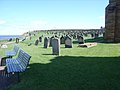 A great number of gravestones - geograph.org.uk - 1423472.jpg 640 × 480; 69 KB
-
 A Last Look.jpg 2,560 × 1,920; 2.35 MB
-
 A Moment in Time.jpg 1,920 × 2,560; 2.79 MB
-
.jpg/120px-A_tribute_to_Frank_Meadow_Sutcliffe_(14528357762).jpg) A tribute to Frank Meadow Sutcliffe (14528357762).jpg 5,472 × 3,648; 2.25 MB
A tribute to Frank Meadow Sutcliffe (14528357762).jpg 5,472 × 3,648; 2.25 MB
-
 A typical Whitby harbour street - geograph.org.uk - 832297.jpg 640 × 480; 101 KB
-
 A very narrow back passage - geograph.org.uk - 832305.jpg 480 × 640; 66 KB
-

-
 A view of Whitby - geograph.org.uk - 1423375.jpg 640 × 480; 104 KB
-
 A165 Lissett to Beeford - geograph.org.uk - 1222523.jpg 640 × 427; 346 KB
-
.jpg/120px-A165_passing_through_Lissett_toward_Hull_and_Beverley_(geograph_7510774).jpg) A165 passing through Lissett toward Hull and Beverley (geograph 7510774).jpg 5,152 × 3,864; 5.35 MB
A165 passing through Lissett toward Hull and Beverley (geograph 7510774).jpg 5,152 × 3,864; 5.35 MB
-
 A165 Towards Beeford - geograph.org.uk - 1307394.jpg 640 × 480; 49 KB
-
 Abandoned Bulldozer, Port Mulgrave - geograph.org.uk - 857698.jpg 640 × 427; 222 KB
-
.jpg/120px-thumbnail.jpg)
-
.jpg/120px-Acer_tree_(3546557887).jpg) Acer tree (3546557887).jpg 2,552 × 2,000; 5.26 MB
Acer tree (3546557887).jpg 2,552 × 2,000; 5.26 MB
-
 Acklam Telephone kiosk .... somewhere - geograph.org.uk - 798138.jpg 640 × 480; 107 KB
-
.jpg/80px-Acklam_Wold_VHF_(geograph_3942575).jpg) Acklam Wold VHF (geograph 3942575).jpg 427 × 640; 67 KB
Acklam Wold VHF (geograph 3942575).jpg 427 × 640; 67 KB
-

-

-
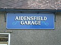 Aidensfield Garage sign - geograph.org.uk - 685499.jpg 640 × 480; 95 KB
-
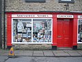 Aidensfield Stores - geograph.org.uk - 685487.jpg 640 × 480; 83 KB
-
 Aidensfield Stores by BR Marshall.jpg 640 × 480; 123 KB
-
 Aislaby war memorial - geograph.org.uk - 810322.jpg 640 × 480; 149 KB
-
 Aldby Park, Buttercrambe - geograph.org.uk - 1712145.jpg 2,229 × 2,787; 1.48 MB
-
 Alessi's Italian restaurant - geograph.org.uk - 833894.jpg 640 × 480; 94 KB
-
.jpg/120px-All_clogged_out_(9554633049).jpg) All clogged out (9554633049).jpg 4,486 × 2,991; 1.48 MB
All clogged out (9554633049).jpg 4,486 × 2,991; 1.48 MB
-
 All Saints Church, Appleton le Street - geograph.org.uk - 579954.jpg 640 × 480; 65 KB
-
 All Saints' Church - geograph.org.uk - 1715781.jpg 2,131 × 1,393; 3.21 MB
-
.jpg/108px-All_the_money_I%27m_owed_..._(6810777364).jpg) All the money I'm owed ... (6810777364).jpg 5,409 × 6,000; 15.26 MB
All the money I'm owed ... (6810777364).jpg 5,409 × 6,000; 15.26 MB
-
 Allerston Mill - geograph.org.uk - 1228378.jpg 640 × 453; 70 KB
-
 Almost at The Dock - geograph.org.uk - 818298.jpg 640 × 480; 78 KB
-
.jpg/120px-Along_Allison_Lane_(geograph_6907672).jpg) Along Allison Lane (geograph 6907672).jpg 1,024 × 683; 484 KB
Along Allison Lane (geograph 6907672).jpg 1,024 × 683; 484 KB
-
 An eastern view across Whitby - geograph.org.uk - 1423500.jpg 640 × 480; 91 KB
-
 AnnBrontegrave.JPG 1,536 × 2,048; 1.33 MB
-
 Another engine at Goathland station.jpg 4,896 × 3,264; 6.65 MB
-
 Anthony house - geograph.org.uk - 216916.jpg 640 × 427; 68 KB
-
 Anthony House - Westerdale - geograph.org.uk - 145091.jpg 640 × 427; 69 KB
-

-
 Arch Cottage, Bulmer.jpg 3,572 × 2,615; 1.48 MB
-
 Arch, All Saints Church, Kilham - geograph.org.uk - 591434.jpg 640 × 480; 85 KB
-
_(9455373104).jpg/120px-Around_Robin_Hood%27s_Bay%2C_Yorkshire_(250070)_(9455373104).jpg) Around Robin Hood's Bay, Yorkshire (250070) (9455373104).jpg 4,416 × 2,762; 2.84 MB
Around Robin Hood's Bay, Yorkshire (250070) (9455373104).jpg 4,416 × 2,762; 2.84 MB
-
 Arriva Bus Departs!.jpg 2,560 × 1,920; 2.41 MB
-
 As far east as i can be bothered to go today - Flickr - Mon Quixote.jpg 1,158 × 879; 740 KB
-

-
 B1242 Towards Bridlington - geograph.org.uk - 1281625.jpg 640 × 480; 78 KB
-
 B1261 Killerby - geograph.org.uk - 242714.jpg 640 × 480; 77 KB
-
 Bandstand in Whitby - geograph.org.uk - 1423392.jpg 640 × 480; 61 KB
-
 Banking Rivals- Barclays vs RBS-NatWest.jpg 2,396 × 1,797; 2.69 MB
-
.jpg/120px-Barley_between_Gransmoor_and_Lissett_(geograph_6907653).jpg) Barley between Gransmoor and Lissett (geograph 6907653).jpg 1,024 × 683; 429 KB
Barley between Gransmoor and Lissett (geograph 6907653).jpg 1,024 × 683; 429 KB
-
.jpg/120px-Barley_near_Hill_Farm_(geograph_6907647).jpg) Barley near Hill Farm (geograph 6907647).jpg 1,024 × 683; 460 KB
Barley near Hill Farm (geograph 6907647).jpg 1,024 × 683; 460 KB
-
 Barnard Lane - geograph.org.uk - 427704.jpg 640 × 360; 89 KB
-
 Barton Moor House - geograph.org.uk - 208287.jpg 640 × 480; 131 KB
-
 Barugh Bridge - geograph.org.uk - 166555.jpg 640 × 480; 131 KB
-
 Barugh House - geograph.org.uk - 261080.jpg 640 × 425; 65 KB
-
.jpg/83px-Beach_Boy_(7250660592).jpg) Beach Boy (7250660592).jpg 993 × 1,429; 633 KB
Beach Boy (7250660592).jpg 993 × 1,429; 633 KB
-
 Beach Huts and Sea Life Centre - geograph.org.uk - 3522733.jpg 640 × 480; 46 KB
-
.jpg/120px-Beach_Huts%2C_Whitby%2C_North_Yorkshire_(52347067823).jpg) Beach Huts, Whitby, North Yorkshire (52347067823).jpg 3,941 × 2,867; 5.02 MB
Beach Huts, Whitby, North Yorkshire (52347067823).jpg 3,941 × 2,867; 5.02 MB
-
 Beach in Front of Hunmanby Gap - geograph.org.uk - 1231134.jpg 640 × 480; 54 KB
-
 Beck Hole Station - memorial plaque.jpg 4,608 × 3,456; 9.3 MB
-
 Beck Isle Cottage - geograph.org.uk - 1719430.jpg 3,600 × 2,025; 1.9 MB
-
_-_geograph.org.uk_-_818294.jpg/120px-Beckfield_(originally_the_Police_Station)_-_geograph.org.uk_-_818294.jpg)
-
 Beech and birch, Castle Howard - geograph.org.uk - 3210075.jpg 1,024 × 735; 278 KB
-
 Beech trees in autumn glory - geograph.org.uk - 3210070.jpg 1,024 × 768; 324 KB
-
.jpg/120px-Bempton_Cliffs%2C_Bridlington%2C_East_Yorkshire_(4530853667).jpg) Bempton Cliffs, Bridlington, East Yorkshire (4530853667).jpg 4,000 × 3,435; 5.46 MB
Bempton Cliffs, Bridlington, East Yorkshire (4530853667).jpg 4,000 × 3,435; 5.46 MB
-
.jpg/101px-Bempton_Cliffs%2C_Bridlington%2C_East_Yorkshire_(4531470382).jpg) Bempton Cliffs, Bridlington, East Yorkshire (4531470382).jpg 3,364 × 4,000; 4.4 MB
Bempton Cliffs, Bridlington, East Yorkshire (4531470382).jpg 3,364 × 4,000; 4.4 MB
-
.jpg/103px-Bempton_Cliffs%2C_Bridlington%2C_East_Yorkshire_(4531478788).jpg) Bempton Cliffs, Bridlington, East Yorkshire (4531478788).jpg 3,428 × 4,000; 6.48 MB
Bempton Cliffs, Bridlington, East Yorkshire (4531478788).jpg 3,428 × 4,000; 6.48 MB
-
.jpg/120px-Birdsall_Church_(geograph_3483985).jpg) Birdsall Church (geograph 3483985).jpg 640 × 427; 102 KB
Birdsall Church (geograph 3483985).jpg 640 × 427; 102 KB
-
 Birdsall House - geograph.org.uk - 573986.jpg 640 × 480; 66 KB
-
 Blackbird on a Branch - Flickr - Charlie From Bristol.jpg 6,217 × 4,338; 21.21 MB
-
 Blacksmith's Arms - geograph.org.uk - 1139320.jpg 640 × 480; 95 KB
-
 Blacksmiths Cottage.jpg 3,024 × 4,032; 4.53 MB
-
 Blakey Ridge.jpg 4,608 × 3,456; 8.26 MB
-
 Blands Cliff Mural - panoramio.jpg 1,917 × 1,896; 548 KB
-
 Blands Cliff Murals - panoramio.jpg 1,719 × 1,883; 685 KB
-
 Bligh's Restaurant.jpg 3,024 × 4,032; 3.66 MB
-
.jpg/120px-Boggle_Hole%2C_Robin_Hoods_Bay_(3548612051).jpg) Boggle Hole, Robin Hoods Bay (3548612051).jpg 3,008 × 2,000; 3.49 MB
Boggle Hole, Robin Hoods Bay (3548612051).jpg 3,008 × 2,000; 3.49 MB
-
 Boggleholebeachrobinhoodsbay.jpg 3,008 × 2,000; 3.49 MB
-
_-_Flickr_-_S._Rae_(1).jpg/120px-Bombus_hypnorum_(Tree_bumblebee)_-_Flickr_-_S._Rae_(1).jpg) Bombus hypnorum (Tree bumblebee) - Flickr - S. Rae (1).jpg 2,348 × 2,072; 1.42 MB
Bombus hypnorum (Tree bumblebee) - Flickr - S. Rae (1).jpg 2,348 × 2,072; 1.42 MB
-
.jpg/120px-Boston_Hotel_on_Bleinhem_Terrace%2C_Scarborough_(geograph_4307336).jpg) Boston Hotel on Bleinhem Terrace, Scarborough (geograph 4307336).jpg 1,600 × 1,062; 405 KB
Boston Hotel on Bleinhem Terrace, Scarborough (geograph 4307336).jpg 1,600 × 1,062; 405 KB
-
 Boundary Stone, Skelderskew Moor - geograph.org.uk - 432563.jpg 640 × 427; 79 KB
-
.jpg/76px-Boynton%2C_St_Andrew%27s_church%2C_font_(42815566411).jpg) Boynton, St Andrew's church, font (42815566411).jpg 2,871 × 4,525; 5.09 MB
Boynton, St Andrew's church, font (42815566411).jpg 2,871 × 4,525; 5.09 MB
-
.jpg/120px-Boynton%2C_St_Andrew%27s_church%2C_interior_from_gallery_(27946813237).jpg) Boynton, St Andrew's church, interior from gallery (27946813237).jpg 5,568 × 3,712; 6.63 MB
Boynton, St Andrew's church, interior from gallery (27946813237).jpg 5,568 × 3,712; 6.63 MB
-
.jpg/68px-Boynton%2C_St_Andrew%27s_church%2C_Sir_William_Strickland_memorial_(27946814627).jpg) Boynton, St Andrew's church, Sir William Strickland memorial (27946814627).jpg 2,954 × 5,186; 5.92 MB
Boynton, St Andrew's church, Sir William Strickland memorial (27946814627).jpg 2,954 × 5,186; 5.92 MB
-
 BR 2-6-4T 80136 shunting at Pickering, September 2019.jpg 5,723 × 3,787; 8.71 MB
-
.jpg/90px-BR_Class_101_Diesel_Multiple_Unit_(33523040460).jpg) BR Class 101 Diesel Multiple Unit (33523040460).jpg 2,464 × 3,285; 1.79 MB
BR Class 101 Diesel Multiple Unit (33523040460).jpg 2,464 × 3,285; 1.79 MB
-
.jpg/120px-BR_Class_101_Diesel_Multiple_Unit_(33858601906).jpg) BR Class 101 Diesel Multiple Unit (33858601906).jpg 1,300 × 867; 579 KB
BR Class 101 Diesel Multiple Unit (33858601906).jpg 1,300 × 867; 579 KB
-
 BR J72 69023 2012-05-06.jpg 4,998 × 3,332; 10.52 MB
-
 Bragg Farmhouse.jpg 5,184 × 3,201; 3.61 MB
-
 Brickdale, Ulrome - geograph.org.uk - 810578.jpg 640 × 449; 115 KB
-
 Brid beach.jpg 2,448 × 3,264; 1,001 KB
-
.jpg/120px-Bridlington_(27601713157).jpg) Bridlington (27601713157).jpg 4,160 × 3,120; 5.26 MB
Bridlington (27601713157).jpg 4,160 × 3,120; 5.26 MB
-
.jpg/120px-Bridlington_(33407445793).jpg) Bridlington (33407445793).jpg 4,000 × 3,000; 2.32 MB
Bridlington (33407445793).jpg 4,000 × 3,000; 2.32 MB
-
.jpg/120px-Bridlington_(33407628013).jpg) Bridlington (33407628013).jpg 4,000 × 3,000; 2.61 MB
Bridlington (33407628013).jpg 4,000 × 3,000; 2.61 MB
-
.jpg/120px-Bridlington_(33834201080).jpg) Bridlington (33834201080).jpg 4,000 × 3,000; 2.21 MB
Bridlington (33834201080).jpg 4,000 × 3,000; 2.21 MB
-
.jpg/120px-Bridlington_(33834268730).jpg) Bridlington (33834268730).jpg 4,000 × 3,000; 2.06 MB
Bridlington (33834268730).jpg 4,000 × 3,000; 2.06 MB
-
.jpg/120px-Bridlington_(34061014622).jpg) Bridlington (34061014622).jpg 4,000 × 3,000; 2.1 MB
Bridlington (34061014622).jpg 4,000 × 3,000; 2.1 MB
-
.jpg/120px-Bridlington_(34087309161).jpg) Bridlington (34087309161).jpg 4,000 × 3,000; 2.51 MB
Bridlington (34087309161).jpg 4,000 × 3,000; 2.51 MB
-
.jpg/120px-Bridlington_(34087431001).jpg) Bridlington (34087431001).jpg 4,000 × 3,000; 2.35 MB
Bridlington (34087431001).jpg 4,000 × 3,000; 2.35 MB
-
.jpg/120px-Bridlington_(34087483571).jpg) Bridlington (34087483571).jpg 4,000 × 3,000; 1.92 MB
Bridlington (34087483571).jpg 4,000 × 3,000; 1.92 MB
-
.jpg/120px-Bridlington_(34177659526).jpg) Bridlington (34177659526).jpg 4,000 × 3,000; 2.83 MB
Bridlington (34177659526).jpg 4,000 × 3,000; 2.83 MB
-
.jpg/120px-Bridlington_(34218357965).jpg) Bridlington (34218357965).jpg 4,000 × 3,000; 2.28 MB
Bridlington (34218357965).jpg 4,000 × 3,000; 2.28 MB
-
.jpg/120px-Bridlington_(42421705102).jpg) Bridlington (42421705102).jpg 4,160 × 3,120; 2.5 MB
Bridlington (42421705102).jpg 4,160 × 3,120; 2.5 MB
-
.jpg/120px-Bridlington_(42472230621).jpg) Bridlington (42472230621).jpg 4,160 × 3,120; 3.5 MB
Bridlington (42472230621).jpg 4,160 × 3,120; 3.5 MB
-
.jpg/120px-Bridlington_(42472261281).jpg) Bridlington (42472261281).jpg 4,160 × 3,120; 1.66 MB
Bridlington (42472261281).jpg 4,160 × 3,120; 1.66 MB
-
 Bridlington beach 1.jpg 640 × 480; 173 KB
-
 Bridlington beach 2.jpg 427 × 640; 35 KB
-
_(34946696126).jpg/120px-Bridlington_Harbour_1905_(archive_ref_PO-1-20-33)_(34946696126).jpg) Bridlington Harbour 1905 (archive ref PO-1-20-33) (34946696126).jpg 900 × 557; 187 KB
Bridlington Harbour 1905 (archive ref PO-1-20-33) (34946696126).jpg 900 × 557; 187 KB
-
_(34854492341).jpg/120px-Bridlington_Harbour_1910_(archive_ref_PO-1-20-38)_(34854492341).jpg) Bridlington Harbour 1910 (archive ref PO-1-20-38) (34854492341).jpg 900 × 555; 146 KB
Bridlington Harbour 1910 (archive ref PO-1-20-38) (34854492341).jpg 900 × 555; 146 KB
-
 Bridlington harbour 9 - panoramio.jpg 1,480 × 899; 207 KB
-
_(34854492101).jpg/120px-Bridlington_Harbour_from_the_south_1910_(archive_ref_PO-1-20-28)_(34854492101).jpg)
-
 Bridlington Main Post Office - geograph.org.uk - 1701965.jpg 800 × 599; 123 KB
-
.jpg/120px-Bridlington_Priory_(34103009872).jpg) Bridlington Priory (34103009872).jpg 4,490 × 3,036; 7.07 MB
Bridlington Priory (34103009872).jpg 4,490 × 3,036; 7.07 MB
-
.jpg/120px-Bridlington_Priory_Interior_(34129583521).jpg) Bridlington Priory Interior (34129583521).jpg 4,052 × 2,646; 5.98 MB
Bridlington Priory Interior (34129583521).jpg 4,052 × 2,646; 5.98 MB
-
.jpg/75px-Bridlington_Priory%2C_west_window_(33876294820).jpg) Bridlington Priory, west window (33876294820).jpg 2,634 × 4,214; 5.8 MB
Bridlington Priory, west window (33876294820).jpg 2,634 × 4,214; 5.8 MB
-
.jpg/69px-Bridlington_Priory%2C_window_(34103002082).jpg) Bridlington Priory, window (34103002082).jpg 2,534 × 4,415; 5.67 MB
Bridlington Priory, window (34103002082).jpg 2,534 × 4,415; 5.67 MB
-
.jpg/82px-Bridlington_Priory%2C_window_(34103002632).jpg) Bridlington Priory, window (34103002632).jpg 2,608 × 3,828; 5.17 MB
Bridlington Priory, window (34103002632).jpg 2,608 × 3,828; 5.17 MB
-
.jpg/87px-Bridlington_Priory%2C_window_(34103004762).jpg) Bridlington Priory, window (34103004762).jpg 2,894 × 3,987; 5.22 MB
Bridlington Priory, window (34103004762).jpg 2,894 × 3,987; 5.22 MB
-
.jpg/88px-Bridlington_Priory%2C_window_(34103006242).jpg) Bridlington Priory, window (34103006242).jpg 2,963 × 4,019; 7.71 MB
Bridlington Priory, window (34103006242).jpg 2,963 × 4,019; 7.71 MB
-
.jpg/27px-Bridlington_Priory%2C_window_(34219871966).jpg) Bridlington Priory, window (34219871966).jpg 888 × 3,936; 3.13 MB
Bridlington Priory, window (34219871966).jpg 888 × 3,936; 3.13 MB
-
.jpg/42px-Bridlington_Priory%2C_window_(34219872546).jpg) Bridlington Priory, window (34219872546).jpg 1,619 × 4,632; 5.22 MB
Bridlington Priory, window (34219872546).jpg 1,619 × 4,632; 5.22 MB
-
.jpg/39px-Bridlington_Priory%2C_window_(34260028025).jpg) Bridlington Priory, window (34260028025).jpg 1,526 × 4,688; 5.79 MB
Bridlington Priory, window (34260028025).jpg 1,526 × 4,688; 5.79 MB
-
 Bridlington Railway Station and Station buffet - 48615585618.jpg 5,111 × 2,968; 2.03 MB
-
 Bridlington Railway Station and Station buffet - 48615930901.jpg 4,656 × 2,892; 2.33 MB
-
 Bridlington Railway Station and Station buffet - 48615934056.jpg 4,684 × 3,452; 2.26 MB
-
 Bridlington Railway Station and Station buffet - 48615937641.jpg 5,174 × 2,325; 1.16 MB
-
 Bridlington Railway Station and Station buffet - 48616077347.jpg 5,297 × 3,489; 2.55 MB
-
 Bridlington Railway Station and Station buffet - 48616077737.jpg 5,472 × 3,648; 2.83 MB
-
 Bridlington Railway Station and Station buffet - 48616080052.jpg 3,361 × 4,842; 2.52 MB
-
 Bridlington Railway Station and Station buffet - 48616080732.jpg 5,472 × 3,648; 2.56 MB
-
 Bridlington Railway Station and Station buffet - 48616080802.jpg 3,045 × 1,113; 447 KB
-
 Bridlington Railway Station and Station buffet- Fire Insurance plates.jpg 4,670 × 1,968; 1.21 MB
-
 Bridlington Railway Station and Station buffet.jpg 5,472 × 3,648; 3.57 MB
-
 Bridlington Station Foyer - geograph.org.uk - 1348966.jpg 640 × 480; 106 KB
-
.jpg/120px-Bridlington_Station%2C_interesting_station_buffet_(geograph_2654110).jpg)
-
 Bridlington Town Centre - geograph.org.uk - 2252067.jpg 1,024 × 768; 265 KB
-
_(28662774101).jpg/120px-Bridlington_Waterworks_Pumping_Station_1922_(archive_ref_DDX2031-3-1)_(28662774101).jpg)
-
.jpg/120px-Bridlington%2C_East_Yorkshire._By_Thomas_Tolkien_(8224644741).jpg) Bridlington, East Yorkshire. By Thomas Tolkien (8224644741).jpg 2,758 × 2,688; 5.54 MB
Bridlington, East Yorkshire. By Thomas Tolkien (8224644741).jpg 2,758 × 2,688; 5.54 MB
-
.jpg/120px-British_Isles_rural_and_coastal_(10308615854).jpg) British Isles rural and coastal (10308615854).jpg 4,608 × 3,072; 1.64 MB
British Isles rural and coastal (10308615854).jpg 4,608 × 3,072; 1.64 MB
-
.jpg/120px-British_Isles_rural_and_coastal_(14510593862).jpg) British Isles rural and coastal (14510593862).jpg 5,024 × 3,349; 2.06 MB
British Isles rural and coastal (14510593862).jpg 5,024 × 3,349; 2.06 MB


.jpg)


.jpg)


.jpg)
.jpg)
.jpg)
.jpg)
.jpg)


.jpg)
.jpg)

.jpg)


.jpg)
.jpg)
.jpg)
.jpg)


.jpg)


.jpg)
.jpg)
.jpg)
.jpg)


.jpg)
.jpg)
.jpg)
.jpg)


.jpg)


.jpg)


.jpg)


.jpg)
.jpg)

.jpg)


.jpg)


.jpg)


.jpg)


_(9455373104).jpg)


.jpg)
.jpg)


.jpg)

.jpg)


_-_geograph.org.uk_-_818294.jpg)


.jpg)
.jpg)
.jpg)
.jpg)


.jpg)

_-_Flickr_-_S._Rae_(1).jpg)
.jpg)

.jpg)
.jpg)
.jpg)

.jpg)
.jpg)


.jpg)
.jpg)
.jpg)
.jpg)
.jpg)
.jpg)
.jpg)
.jpg)
.jpg)
.jpg)
.jpg)
.jpg)
.jpg)
.jpg)


_(34946696126).jpg)
_(34854492341).jpg)

_(34854492101).jpg)

.jpg)
.jpg)
.jpg)
.jpg)
.jpg)
.jpg)
.jpg)


.jpg)

_(28662774101).jpg)
.jpg)
.jpg)
.jpg)
&filefrom=British+Isles+rural+and+coastal+%286133861877%29.jpg#mw-category-media)
.jpg)
.jpg)
.jpg)
.jpg)