Category:Files with coordinates missing SDC location of creation (52° N, 1° W)
Jump to navigation
Jump to search
Media in category "Files with coordinates missing SDC location of creation (52° N, 1° W)"
The following 200 files are in this category, out of 5,806 total.
(previous page) (next page)-
.jpg/95px-%22OILSKI_TURNED_OFFSKI%22_Old_Warden%2C_08-5-2016_(31077546722).jpg) "OILSKI TURNED OFFSKI" Old Warden, 08-5-2016 (31077546722).jpg 2,719 × 3,443; 4.15 MB
"OILSKI TURNED OFFSKI" Old Warden, 08-5-2016 (31077546722).jpg 2,719 × 3,443; 4.15 MB
-

-
 "Warden Garage" display of automobilia at the Shuttleworth Trust - 52505745281.jpg 6,000 × 3,682; 5.02 MB
-
 "Warden Garage" display of automobilia at the Shuttleworth Trust - 52506015159.jpg 2,809 × 4,369; 2.1 MB
-
 "Warden Garage" display of automobilia at the Shuttleworth Trust - 52506296938.jpg 5,593 × 3,607; 4.22 MB
-
 "Warden Garage" display of automobilia at the Shuttleworth Trust - 52506297053.jpg 2,641 × 4,873; 2.65 MB
-
 "Warden Garage" display of automobilia at the Shuttleworth Trust.jpg 5,347 × 2,869; 3.17 MB
-
.jpg/120px-%22Westgate_House%22_co-operative_sign_in_Peterborough_(4508068843).jpg) "Westgate House" co-operative sign in Peterborough (4508068843).jpg 3,381 × 2,229; 597 KB
"Westgate House" co-operative sign in Peterborough (4508068843).jpg 3,381 × 2,229; 597 KB
-
 'A Jack Russell Terrier in the snow'. Squaddie in a field near Belvoir Castle - Dec 2005.JPG 1,920 × 2,560; 3.64 MB
-
 'Amphis' installation at Wysing Arts Centre.jpg 2,448 × 3,264; 898 KB
-
 -2020-10-30 South Street, Bourne, Lincolnshire.jpg 6,252 × 4,164; 4.38 MB
-
 -2020-10-30 West Street, Bourne, Lincolnshire.jpg 6,154 × 4,015; 3.35 MB
-
 -2021-02-15 Looking south along Beech Avenue, Bourne.jpg 3,024 × 4,032; 3.99 MB
-
 -2021-05-21 Beech Avenue, Bourne, Lincolnshire.jpg 3,024 × 4,032; 4.09 MB
-
.jpg/90px--2021-06-01_Looking_east_along_a_footpath_from_Bourne_wood%2C_Bourne_Lincolnshire_(1).jpg) -2021-06-01 Looking east along a footpath from Bourne wood, Bourne Lincolnshire (1).jpg 3,024 × 4,032; 4.39 MB
-2021-06-01 Looking east along a footpath from Bourne wood, Bourne Lincolnshire (1).jpg 3,024 × 4,032; 4.39 MB
-
 -2021-06-01 Looking east along a footpath from Bourne wood, Bourne Lincolnshire.jpg 4,032 × 3,024; 3.75 MB
-
 -2021-06-09 Small leaved lime tree, Bourne Lincolnshire.jpg 3,024 × 4,032; 4.53 MB
-
 -2021-06-12 Burger Van, Saturday Market, Bourne, Linconshire.jpg 6,252 × 4,164; 6.73 MB
-
.jpg/120px--2021-06-12_Saturday_Market%2C_Bourne%2C_Linconshire_(1).jpg) -2021-06-12 Saturday Market, Bourne, Linconshire (1).jpg 6,252 × 4,164; 6.76 MB
-2021-06-12 Saturday Market, Bourne, Linconshire (1).jpg 6,252 × 4,164; 6.76 MB
-
 -2021-06-12 Saturday Market, Bourne, Linconshire.jpg 6,252 × 4,164; 7.88 MB
-
%2C_Bourne.jpg/90px--2021-06-28_Feverfew_(Tanacetum_parthenium)%2C_Bourne.jpg) -2021-06-28 Feverfew (Tanacetum parthenium), Bourne.jpg 3,024 × 4,032; 3.81 MB
-2021-06-28 Feverfew (Tanacetum parthenium), Bourne.jpg 3,024 × 4,032; 3.81 MB
-
 -2021-06-28 Footpath to Saxon Way, Bourne.jpg 3,024 × 4,032; 4.63 MB
-
%2C_Bourne%2C_Lincolnshire.jpg/90px--2021-06-30_Honeysuckle_(Lonicera_periclymenum)%2C_Bourne%2C_Lincolnshire.jpg) -2021-06-30 Honeysuckle (Lonicera periclymenum), Bourne, Lincolnshire.jpg 3,024 × 4,032; 2.77 MB
-2021-06-30 Honeysuckle (Lonicera periclymenum), Bourne, Lincolnshire.jpg 3,024 × 4,032; 2.77 MB
-
.jpg/90px--2021-07-03_Flower_planter%2C_Burghley_Centre%2C_Bourne_(1).jpg) -2021-07-03 Flower planter, Burghley Centre, Bourne (1).jpg 3,024 × 4,032; 3.65 MB
-2021-07-03 Flower planter, Burghley Centre, Bourne (1).jpg 3,024 × 4,032; 3.65 MB
-
 -2021-07-03 Flower planter, Burghley Centre, Bourne.jpg 3,024 × 4,032; 6.21 MB
-
.jpg/120px--2021-07-03_Shop_to_let%2C_Burghley_Centre%2C_Bourne_(1).jpg) -2021-07-03 Shop to let, Burghley Centre, Bourne (1).jpg 4,032 × 3,024; 4 MB
-2021-07-03 Shop to let, Burghley Centre, Bourne (1).jpg 4,032 × 3,024; 4 MB
-
 -2021-07-03 Shop to let, Burghley Centre, Bourne.jpg 3,024 × 4,032; 3.34 MB
-
 -2021-07-08 Beech Avenue, Bourne, Lincolnshire.jpg 3,024 × 4,032; 2.7 MB
-
 -2021-07-08 Godiva Cresecent, Bourne, Lincolnshire.jpg 4,032 × 3,024; 3.7 MB
-
 -2021-07-08 Leofric Avenue, Bourne, Lincolnshire.jpg 3,024 × 4,032; 2.78 MB
-
 -2021-07-12 Flags, Beech Avenue, Bourne, Lincolnshire.jpg 4,032 × 3,024; 3.94 MB
-
 -2021-08-23 Zada Turkish Restaurant, Stamford, Lincolnshire.jpg 4,164 × 6,252; 7.96 MB
-
.jpg/90px--2021-08-24_Tractor_inside_Bourne_Woods%2C_Bourne%2C_Lincolnshire_(1).jpg) -2021-08-24 Tractor inside Bourne Woods, Bourne, Lincolnshire (1).jpg 3,000 × 4,000; 5.76 MB
-2021-08-24 Tractor inside Bourne Woods, Bourne, Lincolnshire (1).jpg 3,000 × 4,000; 5.76 MB
-
 -2021-08-24 Tractor inside Bourne Woods, Bourne, Lincolnshire.jpg 4,000 × 3,000; 7.28 MB
-
 -2021-09-05 Fungus and a tree stump, Lincolnshire.jpg 3,024 × 4,032; 5.93 MB
-
 -2021-10-15 Bungalow on Beech Avenue, Bourne, Lincolnshire.jpg 3,938 × 2,854; 6.11 MB
-
%2C_Beech_Avenue%2C_Bourne%2C_Lincolnshire.jpg/120px--2021-11-02_Elm_tree_(Ulmus)%2C_Beech_Avenue%2C_Bourne%2C_Lincolnshire.jpg) -2021-11-02 Elm tree (Ulmus), Beech Avenue, Bourne, Lincolnshire.jpg 4,027 × 3,024; 7.52 MB
-2021-11-02 Elm tree (Ulmus), Beech Avenue, Bourne, Lincolnshire.jpg 4,027 × 3,024; 7.52 MB
-
 -2021-11-02 Trees, Beech Avenue, Bourne, Lincolnshire.jpg 4,032 × 3,024; 4.61 MB
-
%2C_Beech_Avenue%2C_Bourne%2C_Lincolnshire.jpg/120px--2021-11-03_An_Elm_tree_(Ulmus)%2C_Beech_Avenue%2C_Bourne%2C_Lincolnshire.jpg) -2021-11-03 An Elm tree (Ulmus), Beech Avenue, Bourne, Lincolnshire.jpg 4,032 × 3,024; 5.31 MB
-2021-11-03 An Elm tree (Ulmus), Beech Avenue, Bourne, Lincolnshire.jpg 4,032 × 3,024; 5.31 MB
-
 -2021-11-16 Beech Avenue, Bourne, Lincolnshire.jpg 3,072 × 4,080; 4.98 MB
-
.jpg/120px--2021-12-01_Santa_Clause%2C_Beech_Avenue%2C_Bourne%2C_Linconshire_(1).jpg) -2021-12-01 Santa Clause, Beech Avenue, Bourne, Linconshire (1).jpg 4,080 × 3,072; 2.86 MB
-2021-12-01 Santa Clause, Beech Avenue, Bourne, Linconshire (1).jpg 4,080 × 3,072; 2.86 MB
-
 -2021-12-01 Santa Clause, Beech Avenue, Bourne, Linconshire.jpg 4,080 × 3,072; 3.17 MB
-
 -2021-12-04 Santa and his sleigh, The Burghley Centre, Bourne.jpg 4,080 × 3,072; 4.96 MB
-
 -2021-12-09 Beech Avenue, Bourne, Linconshire.jpg 4,080 × 3,072; 3.14 MB
-
 -2021-12-09 Mercia Avenue, Bourne, Linconshire.jpg 4,080 × 3,072; 3.51 MB
-
 -2022-06-03 Duddington Bridge, Northamptonshire.jpg 6,252 × 4,164; 7.27 MB
-
 -2022-06-04 Plaque, The Raymond Mays public house, North Street, Bourne, Lincolnshire.jpg 3,392 × 4,779; 6.81 MB
-
 -2022-06-04 The Raymond Mays public house, North Street, Bourne, Lincolnshire.jpg 6,252 × 4,164; 6.99 MB
-
 -2022-10-01 Trees in Bourne wood, Bourne, Lincolnshire.jpg 3,072 × 4,080; 6.28 MB
-
 -2022-10-08 View from Bourne wood, Lincolnshire.jpg 4,080 × 3,072; 5.45 MB
-
 -2022-11-14 Looking along a footpath, Bourne, Lincolnshire.jpg 3,072 × 4,080; 5.17 MB
-
 -2022-11-16 Laurel Tree, Bourne wood, Lincolnshire.jpg 3,072 × 4,080; 6.63 MB
-
 -2022-12-01 Santa Clause, Beech Avenue, Bourne, Linconshire.jpg 4,080 × 3,072; 2.75 MB
-
 -2023-01-08 The spire, Parish church of St Mary & St Nicholas, Spalding, Lincolnshire.jpg 4,067 × 6,190; 7.47 MB
-

-
 -2023-01-09 Timber framed house, Cowl Street, Evesham.jpg 1,600 × 1,200; 355 KB
-
 -2023-02-21 Tractor and Trailer, Bourne Wood, Lincolnshire.jpg 1,600 × 1,205; 1.03 MB
-
 -2023-02-21 Tractor, Bourne Wood, Lincolnshire.jpg 1,600 × 1,205; 820 KB
-
.jpg/120px--WEuro2022_MK_Stadium_(52203274164).jpg) -WEuro2022 MK Stadium (52203274164).jpg 4,032 × 2,268; 3.94 MB
-WEuro2022 MK Stadium (52203274164).jpg 4,032 × 2,268; 3.94 MB
-
.jpg/120px-02.09.22_Corby_360117_102_(52368094512).jpg) 02.09.22 Corby 360117 102 (52368094512).jpg 5,611 × 3,442; 13.56 MB
02.09.22 Corby 360117 102 (52368094512).jpg 5,611 × 3,442; 13.56 MB
-
.jpg/91px-05dd06_-roman_colchester_style_brooch_(FindID_104293).jpg) 05dd06 -roman colchester style brooch (FindID 104293).jpg 827 × 1,089; 152 KB
05dd06 -roman colchester style brooch (FindID 104293).jpg 827 × 1,089; 152 KB
-
 08 809 brings the empties up the Ketton Cement branch - 51252729771.jpg 5,419 × 2,731; 1.54 MB
-
 08 809 brings the empties up the Ketton Cement branch.jpg 5,263 × 3,109; 1.61 MB
-
-
 08 809 with the Ketton Cement plant in the background.jpg 3,955 × 1,837; 1.05 MB
-
 08809 in RMS Locotec scheme, Ketton cement branch.jpg 4,837 × 2,155; 1.14 MB
-
 1 Churchgate, Hallaton.jpg 4,000 × 3,000; 3.35 MB
-
 1, Market Place, Corby Glen 03.jpg 4,000 × 3,000; 4.69 MB
-
 1, Market Place, Corby Glen 04.jpg 4,000 × 3,000; 4.83 MB
-
 1, West Street, Bourne 01.jpg 3,000 × 4,000; 5 MB
-
 1, West Street, Bourne 02.jpg 4,000 × 3,000; 4.82 MB
-
 10 Barn Hill.jpg 3,072 × 4,080; 5.97 MB
-
 10 Bedford Street, Ampthill.jpg 4,128 × 3,096; 2.5 MB
-
.jpg/120px-10_Brownlow_Street%2C_Grantham_(geograph_7338669).jpg) 10 Brownlow Street, Grantham (geograph 7338669).jpg 1,024 × 742; 178 KB
10 Brownlow Street, Grantham (geograph 7338669).jpg 1,024 × 742; 178 KB
-
 10 Churchgate, Hallaton.jpg 4,000 × 3,000; 2.93 MB
-
 10 Common Street, Ravenstone.jpg 4,000 × 3,000; 4.03 MB
-
.jpg/120px-10_Main_Street%2C_Caldecott_(geograph_7170359).jpg) 10 Main Street, Caldecott (geograph 7170359).jpg 1,024 × 768; 244 KB
10 Main Street, Caldecott (geograph 7170359).jpg 1,024 × 768; 244 KB
-
.jpg/120px-10_Market_Place%2C_Whittlesey_(geograph_7193362).jpg) 10 Market Place, Whittlesey (geograph 7193362).jpg 1,024 × 768; 174 KB
10 Market Place, Whittlesey (geograph 7193362).jpg 1,024 × 768; 174 KB
-
.jpg/120px-10_Middle_Street%2C_Elton_(geograph_6311860).jpg) 10 Middle Street, Elton (geograph 6311860).jpg 1,024 × 768; 148 KB
10 Middle Street, Elton (geograph 6311860).jpg 1,024 × 768; 148 KB
-
 10 Red Lion Street.jpg 3,072 × 4,080; 3.29 MB
-
 10 St Mary's Hill.jpg 3,072 × 4,080; 5.9 MB
-
 10 St Mary's Street.jpg 3,072 × 4,080; 3.3 MB
-
 10 St Peter's Street.jpg 4,080 × 3,072; 4.84 MB
-
.jpg/120px-10-12_The_Causeway%2C_Godmanchester_(geograph_6942125).jpg) 10-12 The Causeway, Godmanchester (geograph 6942125).jpg 1,024 × 768; 175 KB
10-12 The Causeway, Godmanchester (geograph 6942125).jpg 1,024 × 768; 175 KB
-
 1009 Wolverton "Bloomer" LNWR 2-2-2 replica at MK Museum.jpg 5,107 × 2,983; 1.64 MB
-
 101DXT 1962 RAC Norton ES2.jpg 3,985 × 3,007; 1.66 MB
-
 11 and 12 St Mary's Hill.jpg 4,080 × 3,072; 4.11 MB
-
 11 and 12 St Mary's Street.jpg 4,080 × 3,072; 4.1 MB
-
 11 Austin Street.jpg 4,080 × 3,072; 4.89 MB
-
.jpg/90px-11_Chadley_Lane%2C_Godmanchester_(geograph_6942546).jpg) 11 Chadley Lane, Godmanchester (geograph 6942546).jpg 768 × 1,024; 184 KB
11 Chadley Lane, Godmanchester (geograph 6942546).jpg 768 × 1,024; 184 KB
-
.jpg/120px-11_Church_Way%2C_Little_Stukeley_(geograph_6929424).jpg) 11 Church Way, Little Stukeley (geograph 6929424).jpg 1,024 × 768; 158 KB
11 Church Way, Little Stukeley (geograph 6929424).jpg 1,024 × 768; 158 KB
-
 11 College Street, East Bridgford.jpg 1,280 × 960; 523 KB
-
 11 Common Street, Ravenstone.jpg 4,000 × 3,000; 3.54 MB
-
.jpg/120px-11_Park_Road%2C_Swinstead_(geograph_6839545).jpg) 11 Park Road, Swinstead (geograph 6839545).jpg 1,024 × 811; 180 KB
11 Park Road, Swinstead (geograph 6839545).jpg 1,024 × 811; 180 KB
-
 11 St Martin's.jpg 4,080 × 3,072; 4.53 MB
-
.jpg/120px-11_Stamford_Road%2C_Weldon_(geograph_7283158).jpg) 11 Stamford Road, Weldon (geograph 7283158).jpg 1,024 × 792; 169 KB
11 Stamford Road, Weldon (geograph 7283158).jpg 1,024 × 792; 169 KB
-
.jpg/120px-111_High_Street%2C_Huntingdon_(geograph_6935603).jpg) 111 High Street, Huntingdon (geograph 6935603).jpg 1,024 × 768; 198 KB
111 High Street, Huntingdon (geograph 6935603).jpg 1,024 × 768; 198 KB
-
 12 All Saints Street, Stamford.jpg 3,072 × 4,080; 3.48 MB
-
 12 and 14 Nottingham Road, Cropwell Bishop.jpg 1,280 × 960; 339 KB
-
.jpg/120px-12_Church_Street%2C_Baston_(geograph_6989012).jpg) 12 Church Street, Baston (geograph 6989012).jpg 1,024 × 739; 135 KB
12 Church Street, Baston (geograph 6989012).jpg 1,024 × 739; 135 KB
-
 12 Church Street, Boughton, Northamptonshire.jpg 4,000 × 3,000; 4.03 MB
-
.jpg/120px-12_Dunstable_Street%2C_Ampthill_(October_2023).jpg) 12 Dunstable Street, Ampthill (October 2023).jpg 2,957 × 2,218; 1.89 MB
12 Dunstable Street, Ampthill (October 2023).jpg 2,957 × 2,218; 1.89 MB
-
.jpg/120px-12_Main_Street%2C_Ayston_(geograph_7279354).jpg) 12 Main Street, Ayston (geograph 7279354).jpg 1,024 × 768; 293 KB
12 Main Street, Ayston (geograph 7279354).jpg 1,024 × 768; 293 KB
-
.jpg/120px-12_Main_Street%2C_Preston_(geograph_7291498).jpg) 12 Main Street, Preston (geograph 7291498).jpg 1,024 × 825; 197 KB
12 Main Street, Preston (geograph 7291498).jpg 1,024 × 825; 197 KB
-
.jpg/120px-12_Middle_Street%2C_Elton_(geograph_6311864).jpg) 12 Middle Street, Elton (geograph 6311864).jpg 1,024 × 768; 145 KB
12 Middle Street, Elton (geograph 6311864).jpg 1,024 × 768; 145 KB
-
.jpg/120px-12_Rectory_Lane%2C_Glinton_(geograph_6994905).jpg) 12 Rectory Lane, Glinton (geograph 6994905).jpg 1,024 × 768; 169 KB
12 Rectory Lane, Glinton (geograph 6994905).jpg 1,024 × 768; 169 KB
-
 12, West Street, Bourne.jpg 4,000 × 3,000; 971 KB
-
.jpg/120px-12.05.84_Bedford_St_Johns_Class_104_(6023253395).jpg) 12.05.84 Bedford St Johns Class 104 (6023253395).jpg 1,457 × 956; 255 KB
12.05.84 Bedford St Johns Class 104 (6023253395).jpg 1,457 × 956; 255 KB
-
.jpg/120px-120-124_High_Street%2C_Ramsey_(geograph_5843043).jpg) 120-124 High Street, Ramsey (geograph 5843043).jpg 3,264 × 2,448; 2.74 MB
120-124 High Street, Ramsey (geograph 5843043).jpg 3,264 × 2,448; 2.74 MB
-
 125w MV Homemade Trap - 43180920340.jpg 5,312 × 2,988; 6.78 MB
-
 125w MV Robinson Trap - 51092497649.jpg 1,500 × 844; 1.35 MB
-
 125w MV Robinson Trap overlooking chalk pit - 44992523471.jpg 5,312 × 2,988; 5.79 MB
-
 125w MV Robinson Trap overlooking chalk pit.jpg 2,988 × 5,312; 5.81 MB
-
 1264 Bristol Scout C.jpg 5,263 × 3,289; 2.29 MB
-
.jpg/120px-12A%2C_12B_and_13_Post_Street%2C_Godmanchester_(geograph_6942145).jpg) 12A, 12B and 13 Post Street, Godmanchester (geograph 6942145).jpg 1,024 × 768; 173 KB
12A, 12B and 13 Post Street, Godmanchester (geograph 6942145).jpg 1,024 × 768; 173 KB
-
 13 and 14 Church Street, Boughton, Northamptonshire.jpg 4,000 × 3,000; 3.65 MB
-
 13 Barn Hill.jpg 4,080 × 3,072; 3.59 MB
-
 13 High Street, Stamford.jpg 3,072 × 4,080; 3.64 MB
-
 13 Maiden Lane, 25 and 26 St Mary's Street, Stamford-geograph-5761786-by-Jo-Turner.jpg 4,608 × 3,456; 5.67 MB
-
 13 St Mary's Hill.jpg 4,080 × 3,072; 6.42 MB
-
.jpg/120px-136_High_Street%2C_Huntingdon_(geograph_6942669).jpg) 136 High Street, Huntingdon (geograph 6942669).jpg 1,024 × 768; 163 KB
136 High Street, Huntingdon (geograph 6942669).jpg 1,024 × 768; 163 KB
-
.jpg/120px-138_High_Street%2C_Huntingdon_(geograph_7383046).jpg) 138 High Street, Huntingdon (geograph 7383046).jpg 1,024 × 768; 186 KB
138 High Street, Huntingdon (geograph 7383046).jpg 1,024 × 768; 186 KB
-
 14 All Saints Street, Stamford.jpg 4,080 × 3,072; 4.11 MB
-
 14 and 16, West Street, Bourne.jpg 4,000 × 3,000; 1.07 MB
-
 14 Austin Street.jpg 4,080 × 3,072; 4.06 MB
-
 14 Barn Hill.jpg 4,080 × 3,072; 3.26 MB
-
.jpg/120px-14_Main_Street%2C_Preston_(geograph_7291501).jpg) 14 Main Street, Preston (geograph 7291501).jpg 1,024 × 768; 207 KB
14 Main Street, Preston (geograph 7291501).jpg 1,024 × 768; 207 KB
-
.jpg/120px-14_Spot_ladybird_-_Propylea_quatuordecimpunctata_(35703491871).jpg) 14 Spot ladybird - Propylea quatuordecimpunctata (35703491871).jpg 3,107 × 1,557; 3.02 MB
14 Spot ladybird - Propylea quatuordecimpunctata (35703491871).jpg 3,107 × 1,557; 3.02 MB
-
.jpg/120px-14_The_Causeway%2C_Godmanchester_(geograph_6937055).jpg) 14 The Causeway, Godmanchester (geograph 6937055).jpg 1,024 × 768; 148 KB
14 The Causeway, Godmanchester (geograph 6937055).jpg 1,024 × 768; 148 KB
-
 14 The George Shopping Centre Grantham NG31 6LH.jpg 3,000 × 4,000; 2.97 MB
-
 14 to 17 High Street, Stamford.jpg 4,080 × 3,072; 5.22 MB
-
.jpg/120px-14_West_Street%2C_Oundle_(geograph_6544653).jpg) 14 West Street, Oundle (geograph 6544653).jpg 1,024 × 768; 164 KB
14 West Street, Oundle (geograph 6544653).jpg 1,024 × 768; 164 KB
-
 14, 15 and 16 Common Street, Ravenstone.jpg 4,000 × 3,000; 2.94 MB
-
 15 Church Street, Boughton Northamptonshire.jpg 4,000 × 3,000; 3.31 MB
-
 15 St Peter's Street.jpg 4,080 × 3,072; 4.67 MB
-
.jpg/120px-15_The_Causeway%2C_Godmanchester_(geograph_6937051).jpg) 15 The Causeway, Godmanchester (geograph 6937051).jpg 1,024 × 768; 158 KB
15 The Causeway, Godmanchester (geograph 6937051).jpg 1,024 × 768; 158 KB
-
 15, North Street, Bourne.jpg 4,000 × 3,000; 1,004 KB
-
 15-DX-49 Austin Mini 1100.jpg 3,943 × 2,587; 1.54 MB
-
.jpg/90px-151_High_Street%2C_Huntingdon_(geograph_6943290).jpg) 151 High Street, Huntingdon (geograph 6943290).jpg 768 × 1,024; 234 KB
151 High Street, Huntingdon (geograph 6943290).jpg 768 × 1,024; 234 KB
-
.jpg/120px-152_High_Street%2C_Huntingdon_(geograph_7383367).jpg) 152 High Street, Huntingdon (geograph 7383367).jpg 1,024 × 768; 122 KB
152 High Street, Huntingdon (geograph 7383367).jpg 1,024 × 768; 122 KB
-
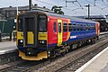 153357 at Peterborough.jpg 4,234 × 2,812; 2.78 MB
-
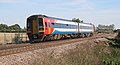
 153366 at Bedford 2012-02-04.jpg 4,070 × 2,705; 6.07 MB
-
 158 852 Whittlesey.jpg 4,305 × 2,329; 1.78 MB
-
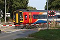 158770 Kings Dyke LC.jpg 5,472 × 3,648; 2.48 MB
-
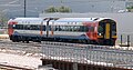
 158773+158864 at Grantham.jpg 3,856 × 2,561; 2.36 MB
-
 158780 Funthams Lane LC.jpg 4,992 × 2,661; 1.74 MB
-
 158783 Ramsey Rd LC.jpg 5,146 × 2,535; 2.14 MB
-
 158783 Whittlesea curves.jpg 3,408 × 1,900; 1.59 MB
-
 158785 Werrington Junction.jpg 2,029 × 1,061; 451 KB
-
 158799 Werrington JUnction.jpg 2,729 × 1,673; 829 KB
-
 158806 Kings Dyke 110822.jpg 3,805 × 2,407; 2.64 MB
-
 158810 Werrington Junction.jpg 3,766 × 3,221; 1.89 MB
-
 158864 Departs Grantham for Norwich.jpg 4,288 × 2,848; 3.38 MB
-
_interceding.jpg/120px-15th_century_wallpainting_of_St_Michael_weighing_a_soul_and_St_Mary_(Vierge_de_la_Misericorde)_interceding.jpg)
-
 16 and 20 Fern Road, Cropwell Bishop.jpg 1,024 × 768; 167 KB
-
 16 Barn Hill.jpg 4,080 × 3,072; 4.59 MB
-
 16 Church Street, Oakham.jpg 4,000 × 3,000; 2.86 MB
-
.jpg/120px-16_Church_Street%2C_Weldon_(geograph_7281430).jpg) 16 Church Street, Weldon (geograph 7281430).jpg 1,024 × 768; 159 KB
16 Church Street, Weldon (geograph 7281430).jpg 1,024 × 768; 159 KB
-
.jpg/120px-16_Churchgate%2C_Hallaton_(geograph_7284898).jpg) 16 Churchgate, Hallaton (geograph 7284898).jpg 1,024 × 768; 176 KB
16 Churchgate, Hallaton (geograph 7284898).jpg 1,024 × 768; 176 KB
-
 160w MBT Robinson Moth Trap.jpg 5,312 × 2,988; 4.91 MB
-
 160w MBT Robinson Trap.jpg 2,988 × 5,312; 4.59 MB
-
_(8516789130).jpg/120px-16698_(R698_DNH)_(8516789130).jpg) 16698 (R698 DNH) (8516789130).jpg 1,280 × 1,024; 81 KB
16698 (R698 DNH) (8516789130).jpg 1,280 × 1,024; 81 KB
-
 17 and 19 Welham Road, Great Bowden.jpg 4,000 × 3,000; 4.75 MB
-
.jpg/120px-17_Burley_Road%2C_Oakham_(geograph_7335863).jpg) 17 Burley Road, Oakham (geograph 7335863).jpg 1,024 × 741; 99 KB
17 Burley Road, Oakham (geograph 7335863).jpg 1,024 × 741; 99 KB
-
.jpg/120px-17_High_Street%2C_Morcott_(geograph_7378145).jpg) 17 High Street, Morcott (geograph 7378145).jpg 1,024 × 768; 253 KB
17 High Street, Morcott (geograph 7378145).jpg 1,024 × 768; 253 KB
-
 17 Northgate, Oakham 01.jpg 4,000 × 3,000; 3.05 MB
-
 17 Northgate, Oakham 02.jpg 4,000 × 3,000; 3.5 MB
-
.jpg/120px-17_Post_Street%2C_Godmanchester_(geograph_6943312).jpg) 17 Post Street, Godmanchester (geograph 6943312).jpg 1,024 × 792; 173 KB
17 Post Street, Godmanchester (geograph 6943312).jpg 1,024 × 792; 173 KB
-
 17 St Mary's Street.jpg 3,072 × 4,080; 3.77 MB
-
 17 to 21 St George's Street.jpg 4,080 × 3,072; 3.87 MB
-
.jpg/120px-17%2C18_The_Causeway%2C_Godmanchester_(geograph_6937047).jpg) 17,18 The Causeway, Godmanchester (geograph 6937047).jpg 1,024 × 767; 149 KB
17,18 The Causeway, Godmanchester (geograph 6937047).jpg 1,024 × 767; 149 KB
-
.jpg/120px-17.09.13_Peterborough_43300_(9791053924).jpg) 17.09.13 Peterborough 43300 (9791053924).jpg 6,016 × 4,000; 11.65 MB
17.09.13 Peterborough 43300 (9791053924).jpg 6,016 × 4,000; 11.65 MB
-
 170 103 Arriva XC unit operating Stansted to Liverpool St service at Whittlesea.jpg 3,541 × 3,046; 1.43 MB
-
 170 636 Ketton SB.jpg 1,930 × 1,275; 696 KB
-
 170101 Whittlesey.jpg 3,165 × 2,514; 1.36 MB
-
 170105 approaches Whittlesea LC.jpg 4,474 × 3,081; 1.66 MB
-
 170105 Whittlesea LC.jpg 4,201 × 1,989; 1.27 MB
-
 170113 Ketton SB.jpg 2,401 × 1,501; 626 KB
-
 170204 , Coates.jpg 2,800 × 1,867; 829 KB
-
 170397 at Peterborough.jpg 4,288 × 2,848; 3.32 MB
-
 170532 East Midlands Railway livery Werrington Junction.jpg 3,951 × 2,646; 2.02 MB
-
 170619 Birmingham-Stansted service at Werrington Junction 160621.jpg 4,657 × 1,969; 1.68 MB
-
 170619 Werrington Junction 2.jpg 4,105 × 2,317; 1.25 MB
-
 170636 Ketton Outer Home.jpg 2,631 × 1,571; 861 KB
-
 170637 Whittlesey.jpg 4,593 × 2,416; 1.61 MB
-
 170639 Whittlesea.jpg 4,089 × 3,424; 2.42 MB
-
.jpg/120px-17th_century_barn_(geograph_7448365).jpg) 17th century barn (geograph 7448365).jpg 6,252 × 4,164; 7.53 MB
17th century barn (geograph 7448365).jpg 6,252 × 4,164; 7.53 MB
-
 18 and 19 High Street, Stamford.jpg 4,080 × 3,072; 3.65 MB
-
 18 Church Street, Oakham.jpg 3,000 × 4,000; 2.84 MB
-
 18 St Mary's Street.jpg 3,072 × 4,080; 3.74 MB
-
 18, North Street, Bourne.jpg 4,000 × 3,000; 1.06 MB
-
 18, West Street, Bourne.jpg 4,103 × 3,138; 1.08 MB
-
 180101 Grand Central Trains at Werrington Junction.jpg 4,686 × 3,331; 2.71 MB
-
 180104 Grand Central Trains Andelante Offord Cluny.jpg 4,381 × 1,901; 1.86 MB
-
 180105 Offord Cluny 211219.jpg 4,611 × 1,916; 1.18 MB
-
 180107 Grand Central Trains at Werrington Junction.jpg 2,806 × 1,766; 710 KB
-
-
_p2.274_-_Belton_House%2C_Lincolnshire.jpg/120px-Neale(1818)_p2.274_-_Belton_House%2C_Lincolnshire.jpg) Neale(1818) p2.274 - Belton House, Lincolnshire.jpg 1,808 × 1,270; 563 KB
Neale(1818) p2.274 - Belton House, Lincolnshire.jpg 1,808 × 1,270; 563 KB
-
.jpg/120px-18th_century_cottage_(geograph_7386557).jpg) 18th century cottage (geograph 7386557).jpg 5,906 × 4,024; 7.78 MB
18th century cottage (geograph 7386557).jpg 5,906 × 4,024; 7.78 MB
-
.jpg/120px-18th_century_houses_(geograph_6821194).jpg) 18th century houses (geograph 6821194).jpg 6,252 × 4,164; 3.57 MB
18th century houses (geograph 6821194).jpg 6,252 × 4,164; 3.57 MB
.jpg)


.jpg)


.jpg)


.jpg)

,_Bourne.jpg)

,_Bourne,_Lincolnshire.jpg)
.jpg)

.jpg)


.jpg)


,_Beech_Avenue,_Bourne,_Lincolnshire.jpg)

,_Beech_Avenue,_Bourne,_Lincolnshire.jpg)

.jpg)


.jpg)
.jpg)
.jpg)


.jpg)


.jpg)
.jpg)
.jpg)


.jpg)


.jpg)
.jpg)


.jpg)

.jpg)
.jpg)


.jpg)

.jpg)
.jpg)
.jpg)
.jpg)
.jpg)

.jpg)
.jpg)


.jpg)


.jpg)
.jpg)


.jpg)
.jpg)
.jpg)


.jpg)


.jpg)


.jpg)
.jpg)


_interceding.jpg)


.jpg)
.jpg)


_(8516789130).jpg)

.jpg)
.jpg)


.jpg)


.jpg)
.jpg)


.jpg)


_p2.274_-_Belton_House,_Lincolnshire.jpg)
.jpg)
.jpg)
&filefrom=19+and+21%2C+West+Street%2C+Bourne.jpg#mw-category-media)